
By PAULA TRACY, InDepthNH.org
From Upper Coos to Hinsdale, New Hampshire has hundreds of miles of recreational rail trail getting plenty of use these days during the COVID-19 crisis.
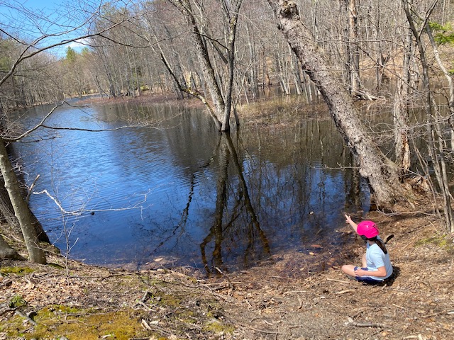
Walkers, bikers, inline skaters and runners, dogs, and babies in baby carriages enjoy the miles of rail trail.
One of these great swaths of public land, which go through woods and fields and alongside rivers and lakes with mountain views, and even though downtowns, is likely near your home.
Chris Gamache, chief of the New Hampshire Bureau of Trails said non-motorized use of the trails “is through the roof,” right now as the state deals with stay-at-home measures during the coronavirus.
Gov. Chris Sununu wants to keep recreational rail trails available to the public for passive, dispersed use during the pandemic, Gamache said, and people are enjoying their local trails to get a bit of fresh air and exercise.
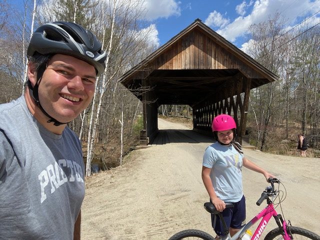
Rail trails are ideal right now because people are moving, not congregating, said Mike Vlacich of Concord. He and his family have been enjoying the Northern Rail trail on their bicycles with rides in Boscawen along the Merrimack River and one recently where they drove to Potter Place in Andover, parked their vehicle and rode along past covered bridges in the shadow of Mount Kearsarge.
“People are moving briskly. There is no lingering. You can go for miles without seeing anyone because the trails are so long,” he said.
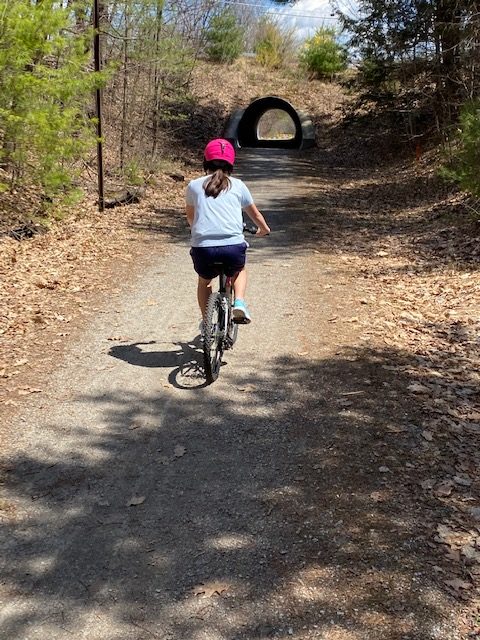
In fact, the Northern Recreation Rail trail runs 54 miles from Boscawen to downtown Lebanon and is mostly a surface made of stone dust, which is great for mountain bikes.
History
In the 1800s, rail was the way for merchandise and transportation linking towns and cities in New Hampshire. It was developed privately by the railroad companies.
The advent of the automobile and road development gradually changed all that and by the 1940s rail companies were abandoning lines. Gamache said the companies normally gave the state the right of first refusal when selling the property and in most cases, the state acquired them.
Gamache said there are about 300 miles of “abandoned” rail in the state that are useable for recreation and about 200 active miles of line, which include commuter service on the Seacoast and Claremont area, excursion use in Conway, Lincoln, Plymouth and Laconia and some freight rail mostly in the southern part of the state.
Local communities also have developed their rail rights of way and have agreements with the state.
Gamache said in the past 15 years he has seen the accelerated growth and the transitions from rail ties and cinder to pavement and ground stone for miles of non-motorized recreational and motorized recreational use throughout the state.
Parking
In the past few weeks, he said, he has been hearing from local law enforcement around the trails about increased signage because people are parking badly. They are blocking first responder access at times, the very help they might need.
Gamache noted that the money for improvements in the system has largely come from license sales of snowmobiles and ATVs and volunteer groups around the state have helped provide resources and labor.
So a big thanks for partnering to make these trails happen because, in the winter, they are used in many cases by snowmobilers.
Looking for a local rail trail, I found the WOW.
I began by looking at the maps here to find the best local recreational rail-trail I could find from my house.
New Hampshire State Parks has a list of recreational rail-trails across the state at https://www.nhstateparks.org/visit/recreational-rail-trails.
But I found the closest spot to me was a municipal rail-trail in nearby Laconia. The WOW Trail is a 10-foot wide swath of pavement from Lakeport to Belmont.
It is supposedly an acronym for Winnipesaukee-Opechee-Winnisquam but it’s actually “OW” because I don’t see any Winnipesaukee here, at least not yet and according to recent news accounts, not likely any time soon because of costs and abutter opposition.
The rail-trail follows along the shores of Lake Opechee and Winnisquam right now and it follows an active rail line similar to municipal rails trails in Goffstown, Claremont and Nashua.
I found the trail was in fabulous shape. It took in a number of views that I had not enjoyed of the lakes region before and people of all ages were out enjoying it.
NH DOT
It’s been a bit of connecting the dots in southern New Hampshire where rail-trails have the ability to connect communities.
https://www.nh.gov/dot/programs/bikeped/maps/index.htm#maps
Gamache said initiatives are still in the works to fully connect aspects of the Rockingham Rail Trail together in the area of Londonderry but there is federal FAA approval required near the Manchester-Boston Regional Airport.
Still, these rail-trails are mostly flat, they go along water bodies, behind factories and neighborhoods.
And a private effort has created The Cross New Hampshire Adventure Trail, an interesting 83 miles from Wells River, Vt. through the Whites to Jefferson and into Maine on Route 2 in Gilead http://www.xnhat.org/?fbclid=IwAR11ML_eKk6ZD7CqYsCSQNvpId454PqCQuGI_IE-TDsOUz0cuU-O4ro81I0
If you go, bring plenty of water, your own snacks, and a cell phone and remember to park responsibly and carry out any trash.
Among the many rail-trails in the state are the following ones which maybe near your home.
– The Upper Coos Recreational Rail Trail from Colebrook to Beecher Falls, Vt. runs for 10 miles along the Connecticut River and allows ATVs.
– The Presidential Recreational Rail Trail from Jefferson to Gorham is 18.3 miles-The Winni River Trail follows the rapids along the river between Northfield and Franklin
– The WOW trail runs from Laconia’s Lakeport area to Belmont along the edges of Lake Opechee and Winnisquam and is paved.
– The Ammonoosuc Recreational Rail Trail is 19 miles, beginning on Central Street in Woodsville and going to Littleton’s Industrial Park. It passes the historic Bath Covered Bridge and Lisbon’s beautiful old rail depot
– The Profile Recreational Rail Trail in Bethlehem is 1.5 miles, it is difficult to get to and the surface is rough.
– The Cotton Valley Recreational Trail from Wolfeboro to Wakefield is popular for bicycles and has been recently improved. It is 12 miles and put-put cars on the rail trails still use it. The Cotton Valley Rail Trail Club help maintain it.
– The Warren Rail Trail is between four and six miles in length, gravel, and allows ATVs.
– The Manchester/Lawrence Recreational Rail trail is really three trails with spurs to Windham Rail Trail (paved) Derry Rail Trail (paved) and Londonderry Rail Trail (paved with stone dust)
– The Northern Recreational Rail Trail from Boscawen to Lebanon begins at the Hannah Dustin park and ride, includes a good parking area at Potter Place in Lebanon andrminates behind the Lebanon Opera House and is 54 miles of mostly stone dust surface.
– The Fort Hill Recreational Rail Trail in Hinsdale is nine miles in length.-The Sugar River Recreational Rail Trail is from Newport to Claremont and is 9.5 miles of gravel surface.
– The Farmington Recreational Rail trail is six miles from Farmington to Rochester.
– The Rockingham RailTrail Portsmouth Branch runs from Manchester to Newfields and is 25 miles long.
– The Monadnock Recreational Rail Trail is seven miles through the Peterborough area
– The Hillsborough Recreational Rail Trail runs 7.7 miles between Hillsboro and Bennington
– The Cheshire Recreational Rail Trail goes from North Walpole to Fitzwilliam but it is broken up in the middle by Keene. In total, it is 42 miles in length.
– The Ashuelot Recreational Rail Trail from Keene to Hinsdale is 21 miles.
– The Greenville Recreational Rail Trail is 2.2 miles and mostly gravel to Mason