The following National Weather Service forecast is for Concord, NH. Find the forecast for your town or city by going to the National Weather Service website by clicking the link below. Then in the upper left hand corner, type in where you live.
https://forecast.weather.gov/MapClick.php?lat=43.2096&lon=-71.5373
Tonight
A slight chance of showers and thunderstorms between 7pm and 9pm. Mostly cloudy, with a low around 68. South wind around 5 mph. Chance of precipitation is 20%.
Juneteenth
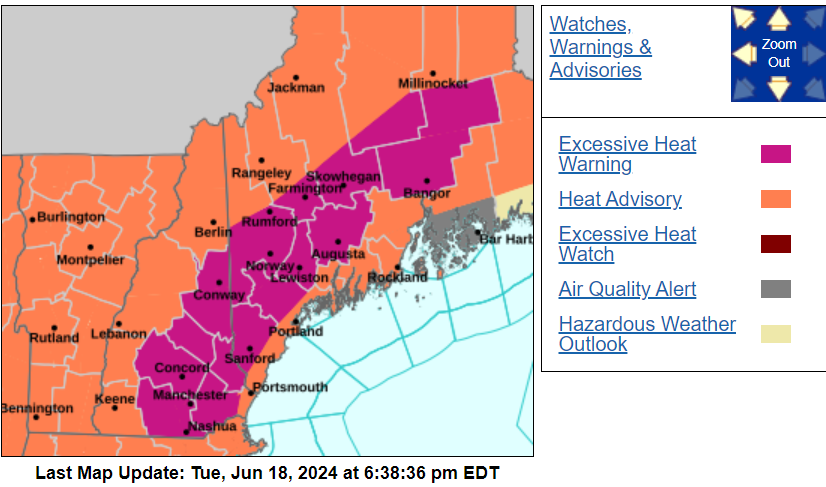
Mostly sunny and hot, with a high near 97. Heat index values as high as 103. Calm wind becoming southwest around 5 mph in the afternoon.
Wednesday Night
A 20 percent chance of showers and thunderstorms before 10pm. Mostly cloudy, with a low around 70. Southwest wind around 5 mph becoming calm in the evening.
Thursday
A 30 percent chance of showers and thunderstorms after 2pm. Partly sunny and hot, with a high near 98. Heat index values as high as 104. West wind around 5 mph.
Thursday Night
A chance of showers and thunderstorms before 8pm, then a chance of showers between 8pm and 2am. Mostly cloudy, with a low around 70. Northwest wind around 5 mph becoming calm in the evening. Chance of precipitation is 30%.
Friday
A chance of showers between 8am and 2pm, then a chance of showers and thunderstorms after 2pm. Partly sunny, with a high near 87. Chance of precipitation is 40%.
Friday Night
A chance of thunderstorms before 8pm, then a chance of showers after 2am. Mostly cloudy, with a low around 63. Chance of precipitation is 30%.