Get the most updated forecast here: https://www.weather.gov/gyx/weatherstory
From National Weather Service at 4:20 p.m. Wednesday
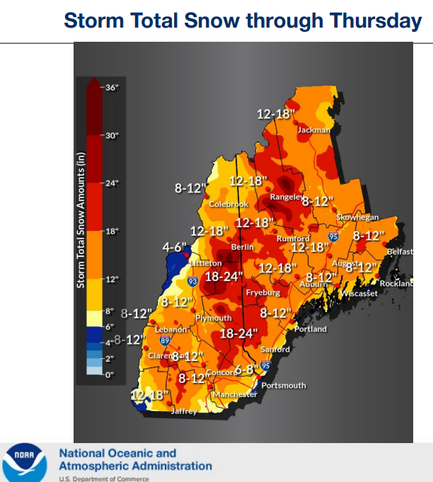
* Heavy snow accumulations and snowfall rates are likely,
especially tonight into Thursday morning.
* Sleet is likely over southern New Hampshire before a change to
all snow.
* Snow may be wet/sticky especially south of the mountains and
on the coast. This may cause limbs to break and result in power
outages.
* Gusty to damaging winds on the coast, coastal waters, and
western slopes of the mountains.
* Minor to moderate coastal flooding with moderate splash-over
likely Thursday morning.
* The lowest confidence in snowfall amounts remains over
southern New Hampshire and southwest coastal Maine, where
mixing may still reduce totals.